
Drought
Drought is a complex physical and social phenomenon of wedespread significance. While lower than normal precipitation is usually the cause of specific problems creating a drought situation, a drought condition is not simply a lack of rainfall or snow accumulation but can also be related to difficiencies in soil moisture and groundwater; lack of surface water in streams and rivers; and/or reduction of surface water stored in lakes and reservoirs. A number of factors are involved in determining if drought exists and its severity for a given region: precipitation, snowpack, soil moisture, streamflow, surface water storage, and groundwater levels. (State of Nevada Drought Response Plan, revised April 2012)
Nevada and California have experienced drought for many consecutive years and it is important to be mindful of water use. Truckee Meadows Water Authority and Southern nevada Water Authority reccomend and give instruction for water-efficient landscaping and other water conservation practices, techniques and technologies.

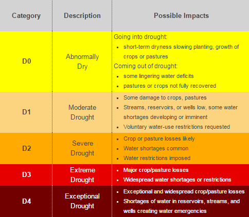 |
U.S. Drought Monitor maps come out every Thursday morning at 8:30 Eastern Time, based on data through 7 a.m. Eastern Standard Time (8 a.m. Eastern Daylight Time) the preceding Tuesday. The map is based on measurements of climatic, hydrologic and soil conditions as well as reported impacts and observations from more than 350 contributors around the country. Eleven climatologists from the partner organizations take turns serving as the lead author each week. The authors examine all the data and use their best judgment to reconcile any differences in what different sources are saying. The U.S. Drought Monitor is jointly produced by the National Drought Mitigation Center at the University of Nebraska-Lincoln, the United States Department of Agriculture, and the National Oceanic and Atmospheric Administration. Map courtesy of NDMC-UNL.
|


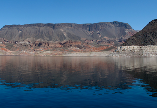
See examples of Drought in your own backyard
![]()
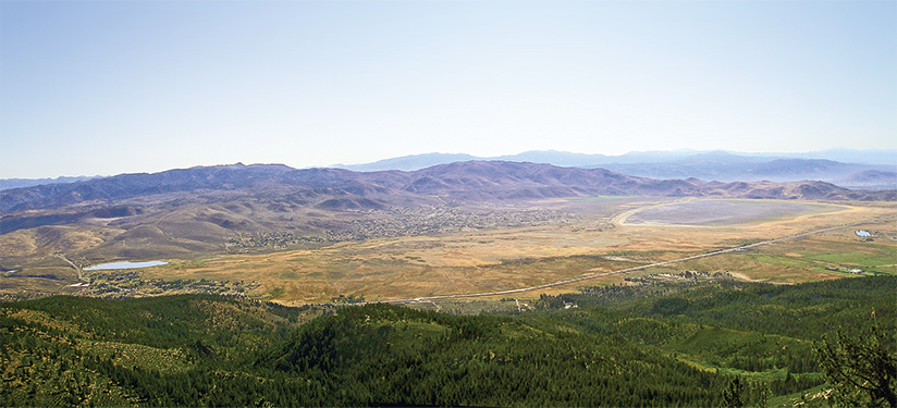
Image shows a view of Washoe Lake in Northern Nevada during a period of drought in 2004 versus normal conditions seen in 2006. Photos by James.
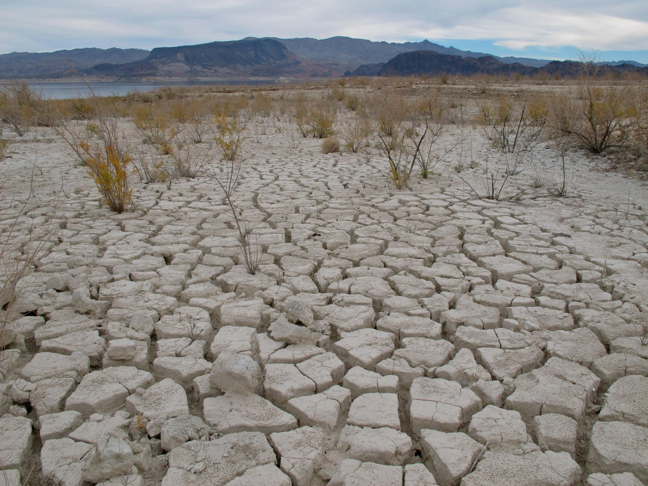
Shows lower levels of Lake Mead in southern Nevada, dried up lake sediments are exposed by receeding lake level. High water mark exposed in distance. Areas can become susceptible to invasion of noxious weeds such as tamarisk. Photo by Angel La Canfora, 2015.
 |
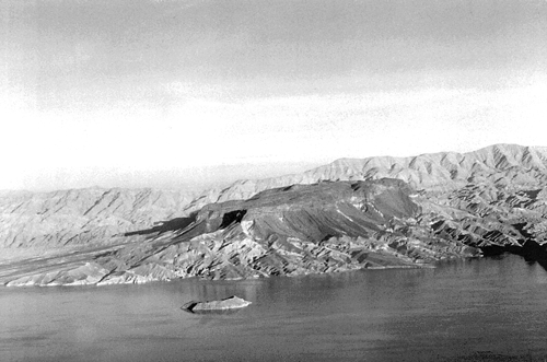 |
Left: View of Fortification Hill in 2013, showing high water mark as lake levels are drawn down. Right: Aerial view of Fortification Hill in 1993 with light colored granitic rocks of the Wilson Range in the background. Photos by Angel La Canfora and Becky Purkey.
Links/Resources
Southern Nevada Water Authority
Truckee Meadows Water Authority
 Home
Home