
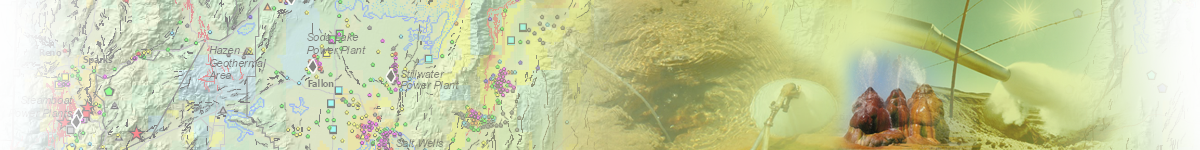
Geothermal Energy:
Home | Published Maps | Interactive Maps | Data | Great Basin Groundwater | Geochemical
Database | Geothermal Leasing on Federal Lands | Recent Geothermal Projects/Exploration Activity | Additional Resources
Geologic Maps
NBMG geologic maps that are listed in the AZGS Repository are also listed below.
Scale: 12k | 24k| 48k | 50k | 62.5k | 100k | 125k | 250k | 500k | 750k | 1 mill | Other
24k
Bedrock Geologic Map of the Goldyke Quadrangle, Nye County, Nevada
Geologic Map and Sections of the Ely Quadrangle, White Pine County, Nevada, USGS GQ-697
Geologic Map and Sections of the Southern Cherry Creek and Northern Egan Ranges,
White Pine County, Nevada, NBMG M35
Geologic Map of the Antler Peak Quadrangle, Lander County, Nevada, NBMG B109
Geologic Map of the Argenta Quadrangle, Lander County, Nevada, NBMG OFR 00-07
Geologic Map of the Arrow Canyon NW Quadrangle in Clark County, Nevada, USGS, GQ-1776
Geologic Map of the Basalt Quadrangle, Mineral County, Nevada, USGS OF81-369
Geologic Map of the Bateman Springs Quadrangle, Lander County, Nevada, NBMG OF00-08
Geologic Map of the Battle Mountain Quadrangle, Lander County, Nevada, NBMG M130
Geologic Map of the Beaver Peak Quadrangle, Elko and Eureka Counties, Nevada, NBMG M143
Geologic Map of the Bedell Flat Quadrangle, Washoe County, Nevada, NBMG FS03
Geologic Map of the Bell Canyon Quadrangle, in Churchill County, Nevada, NBMG FS11
Geologic Map of the Bell Mountain Quadrangle, in Churchill County, Nevada, NBMG FS12
Geologic Map of the Belmont East quadrangle in Nye County, Nevada, USGS I-2675
Geologic Map of the Belmont West Quadrangle in Nye County, Nevada, USGS GQ-1801
Geologic Map of the Bettles Well Quadrangle in Mineral County, Nevada, NBMG FS01
Geologic Map of the Big Bald Mountain Quadrangle and Part of the Toginin Spring Quadrangle,
White Pine County, Nevada, NBMG M145
Geologic Map of the Blue Basin Quadrangle, Elko County, Nevada, USGS MF559
Geologic Map of the Blue Diamond NE Quadrangle, Clark County, Nevada, NBMG M124
Geologic Map of the Blue Diamond SE Quadrangle, Clark County, Nevada, NBMG M123
Geologic map of the Bobs Flat Quadrangle in Eureka County, Nevada, NBMG M138
Geologic Map of the Boulder Beach Quadrangle, Nevada, NBMG M81
Geologic Map of the Bristol Well quadrangle in Lincoln County, Nevada [Preliminary, USGS OFR 95-580]
Geologic Map of the Brooks Spring Quadrangle in Humboldt County, Nevada, USGS GQ-1366
Geologic Map of the Buckskin Mountain Quadrangle in Humboldt County, Nevada, NBMG M88
Geologic Map of the Bullfrog NW Quadrangle in Nye County, Nevada, USGS I-1985
Geologic Map of the Bull Run Mountains, Elko County, Nevada, NBMG OF86-12
Geologic Map of the Bunejug Mountains Quadrangle, Churchill County, Nevada, NBMG OFR11-9
Geologic Map of the Callville Bay Quadrangle, Clark County, Nevada and Mohave County, Arizona, NBMG M139
Geologic Map of the Camp Desert Rock Quadrangle, Nye County, Nevada, USGS GQ726
Geologic Map of the Camp Douglas Quadrangle in Mineral County, Nevada, NBMG M63
Geologic Map of the Carlin Trend, Elko County, Nevada, Plate 1, NBMG OF04-09
Geologic Map of the Carson City Quadrangle, Nevada, NBMG 1Ag
Geologic Map of the Castle Mountains Quadrangle, San Bernadrdino County, California and Clark County, NBMG M108
Geologic Map of the Chief Mountain Quadrangle in Lincoln County, Nevada, USGS GQ-1731
Geologic Map of the Coal Mine Basin Quadrangle, Elko County, Nevada, USGS MF528
Geologic Map of the Cooper Peak Quadrangle, Eureka County, Nevada, NBMG M159
Geologic Map of the Corcoran Canyon quadrangle, Nye County, Nevada, USGS I-2680
Geologic Map of the Corn Creek Springs NW Quadrangle, Clark County, Nevada, NBMG OFR12-7
Geologic Map of the Corn Creek Springs Quadrangle, Nevada, NBMG M121
Geologic Map of The Cove Quadrangle, White Pine County, Nevada and Utah, NBMG FS22
Geologic Map of the Coyote Spring Quadrangle, Lincoln County, Nevada, USGS OFR95-550
Geologic Map of the Crater Flat Area Nevada, NBMG M101
Geologic Map of the Davis Dam Quadrangle, and Eastern Part of the Bridge Canyon Quadrangle,
Clark County, Nevada, and Mohave County, Arizona NBMG OFR03-5109
Geologic Map of the Deadman Spring SE Quadrangle, Lincoln County, Nevada, USGS GQ1745
Geologic Map of the Delamar 3 SE quadrangle in Lincoln County, Nevada, USGS GQ-1754
Geologic Map of the Delamar Lake Quadrangle, Lincoln County, Nevada, USGS GQ-1730
Geologic Map of the Delvada Spring Quadrangle, Humboldt County, Nevada, NBMG FS13
Geologic Map of the Desert Peak Quadrangle, Churchill County, Nevada, NBMG OFR12-5
Geologic Map of the Devils Throat Quadrangle, Clark County, Nevada, NBMG Map M181
Geologic Map of the Dogskin Mountain Quadrangle, Washoe County, Nevada, NBMG M148
Geologic Map of the Eugene Mountains, Northwestern Nevada, NBMG M115
Geologic Map of the Fairview Range and Grassy Mountain, Lincoln County, Nevada, NBMG M114
Geologic Map of the Fire Mountain Quadrangle, Nevada and Arizona
Geologic Map of the Fraser Flat Quadrangle and the West half of the Moses Rock Quadrangle,
Washoe County, Nevada
Geologic Map of the Frazier Creek Quadrangle, Nevada
Geologic Map of the Frenchman Mountain Quadrangle, Clark County, Nevada
Geologic Map of the Gass Peak Quadrangle, Clark County, Nevada, NBMG M175
Geologic Map of the Genoa Quadrangle, Carson City Area, Douglas County, Nevada
Geologic Map of the Glenbrook Quadrangle, Lake Tahoe Area, Nevada
Geologic Map of the Golconda Quadrangle, Humboldt County, Nevada, USGS GQ-1174
Geologic Map of the Goldrun Creek Quadrangle, Humboldt County, Nevada
Geologic Map of the Government Wash Quadrangle, Clark County, Nevada, NBMG M140
Geologic Map of the Granite Mountain Quadrangle, Pershing County, Nevada, USGS OF80-715
Geologic Map of the Granite Peak Quadrangle, Washoe County, Nevada, and Lassen County, California,
NBMG OF87-08
Geologic Map of the Grimes Point Quadrangle, Churchill County, Nevada, NBMG M173
Geologic Map of the Hazen Quadrangle, Lyon and Churchill Counties, Nevada, NBMG OFR11-8
Geologic Map of the Henderson Quadrangle, Clark County, Nevada, NBMG M67
Geologic Map of the High Rock Lake Quadrangle, Washoe and Humboldt Counties, Nevada
Geologic Map of the Hiller Mountains Quadrangle, Clark County, Nevada and Mohave County, Arizona, NBMG M137
Geologic Map of the Hoover Dam Quadrangle, Arizona and Nevada, NBMG M102
Geologic Map of the Hot Springs Peak Quadrangle and the Southeastern Part of the Little Poverty Quadrangle
in Humboldt County, Nevada
Geologic Map of the Huntsman Ranch Quadrangle, Elko County, Nevada, NBMG M163
Geologic Map of the Iceberg Canyon Quadrangle, Clark County, Nevada and Mohave County, Arizona, NBMG M166
Geologic Map of the Indian Cove quadrangle, Lincoln County, Nevada, USGS GQ-1701
Geologic Map of the Iron Point Quadrangle, Humboldt County, Nevada, USGS, GQ-1175
Geologic Map of the Izzenhood Spring Quadrangle, Lander County, Nevada
Geologic Map of the Jake Creek Mountain Quadrangle, Elko County, Nevada
Geologic Map of the Jean Quadrangle, Clark County, Nevada, NBMG M176
Geologic Map of the Jefferson Quadrangle in Nye County, Nevada, USGS I-2670
Geologic Map of the Job Peak Quadrangle, Nevada, NBMG FS05
Geologic Map of the Kelly Creek Area, Humboldt, Elko, and Lander Counties, Nevada, NBMG OF05-01
Geologic Map of the Lahontan Mountains and Grimes Point Quadrangles, Churchill County, Nevada, NBMG M168
Geologic Map of the Lahontan Mountains Quadrangle, Churchill County, Nevada, NBMG M168_2
Geologic Map of the Lamoille Quadrangle, Elko County, Nevada, NBMG M125
Geologic Map of the La Plata Canyon Quadrangle, Churchill County County, Nevada, USGS GQ1710
Geologic Map of the Last Chance Peak Quadrangle, Nye County, Nevada, NBMG OF03-14
Geologic Map of the Las Vegas NE quadrangle, Clark County, Nevada, NBMG 3Cg
Geologic Map of the Las Vegas NW Quadrangle, Nevada, NBMG 3Dg
Geologic Map of the Las Vegas SE Quadrangle, Clark County, Nevada, NBMG 3Ag
Geologic Map of the Las Vegas SW Quadrangle, Clark County, Nevada, NBMG 3Bg
Geologic Map of the Lathrop Wells quadrangle in Nye County, Nevada, USGS GQ-883
Geologic Map of the Lehman Caves quadrangle, White Pine County, Nevada, USGS GQ-1758
Geologic Map of the Lime Mountain Quadrangle, Lincoln County, Nevada, NBMG M129
Geologic Map of the Little Horse Canyon Quadrangle, White Pine County, Nevada and Millard County, Utah,
NBMG FS20
Geologic Map of the Mable Mountain quadrangle in Mineral County, Nevada, USGS MF-1486
Geologic Map of the Manhattan Quadrangle in Nye County, Nevada, USGS GQ-1775
Geologic Map of the Marlette Lake Quadrangle, Carson City, Nevada, NBMG 2Cg
Geologic Map of the McTarnahan Hill Quadrangle, Douglas County, Nevada, NBMG OF99-05
Geologic Map of the Meadview North Quadrangle in Mohave County, Arizona and Clark County, Nevada, NBMG M154
Geologic map of the Miller Mountain and Columbus quadrangles, Mineral and Esmeralda Counties, Nevada,
USGS OF79-1145
Geologic Map of the Mina Quadrangle, Mineral County, Nevada, FS06
Geologic Map of the Minden Quadrangle, Douglas County, Nevada, and Alpine County, California, NBMG OF03-13
Geologic Map of the Moapa West Quadrangle, Clark County, Nevada, USGS OFR96-521
Geologic Map of the Moho Mountain Quadrangle, in Mineral County, Nevada, NBMG M74
Geologic Map of the Mormon Jack Pass Quadrangle, White Pine County, Nevada, NBMG FS17
Geologic Map of the Mountain City NW quadrangle in Elko County, Nevada, USGS OFR 84-685
Geologic Map of the Mountain City SW quadrangle in Elko County, Nevada, USGS OFR 84-686
Geologic Map of the Mount Blitzen Quadrangle, Elko County, Nevada, NBMG M110
Geologic Map of the Mount Moriah Quadrangle, White Pine County, Nevada and Millard County, Utah, NBMG FS19
Geologic Map of the Mt. Davis Quadrangle, Clark County, Nevada and Mohave County, Arizona, NBMG M105
Geologic Map of the Mt. Rose NE Quadrangle, Washoe County, Nevada, NBMG 4Bg
Geologic map of the Mule Canyon quadrangle, Lander County, Nevada, NBMG M144
Geologic Map of the Nelson SW Quadrangle, Clark County, Nevada, NBMG M134
Geologic Map of the New Empire Quadrangle, Carson City County, Nevada, NBMG M59
Geologic Map of the Nixon Area Quadrangle, Washoe County, Nevada, NBMG M152
Geologic Map of the Northeastern Bullfrog Hills and Vicinity, Southern Nye County, Nevada
Geologic Map of the Northeast Quarter of the Bullfrog 15-minute Quadrangle in Nye County, Nevada, USGS I-2049
Geologic Map of the Northeast Quarter of the Nopah Peak Quadrangle, Nye County, Nevada, and Inyo County, California, NBMG OFR03-19
Geologic Map of the northeast quarter of the Stewart Valley Quadrangle, Nye County, Nevada, and Inyo County, California USGS OF03-20
Geologic Map of the Northern Adobe Range, Elko County, Nevada, USGS I2081
Geologic Map of the Northern Shoshone Range in Lander and Eureka Counties, Nevada, USGS, PP-465
Geologic Map of the North Half of the Fourth of July Mountain Quadrangle, Clark County, Nevada, NBMG OFR12-8
Geologic Map of the Oak Spring Butte Quadrangle in Nye County, Nevada, USGS GQ-822
Geologic Map of the Old Mans Canyon Quadrangle, White Pine County, Nevada and Millard County, Utah, NBMG FS21
Geologic Map of the Olinghouse Quadrangle, Washoe County, Nevada, NBMG M157
Geologic Map of the Oxley Peak Area, Elko County, Nevada, USGS OF03-4
Geologic Map of the Pah Rah Mountain quadrangle, Washoe County, Nevada, NBMG OF04-03
Geologic Map of the Pahroc Springs Quadrangle in Lincoln County, Nevada, USGS GQ1752
Geologic Map of the Pahrump Quadrangle, Nye County, Nevada, NBMG OF99-14
Geologic Map of the Pamlico quadrangle, Mineral County, Nevada, USGS MF-1485
Geologic Map of the Peko Hills quadrangle, Elko County, Nevada, USGS I-1902
Geologic Map of the Pintail Bay Quadrangle, Churchill County, Nevada, NBMG FS08
Geologic Map of the Pirouette Mountain Quadrangle, Churchill County, Nevada, NBMG FS9
Geologic Map of the Plutonium Valley Quadrangle, Nye and Lincoln County, Nevada, USGS GQ384
Geologic Map of the Rattlesnake Flat quadrangle, Mineral County, Nevada, USGS OFR-84-506
Geologic Map of the Reese River Geothermal Area, Lander County, Nevada, NBMG OFR11-3
Geologic Map of the Reno NE quadrangle, Washoe County, Nevada, NBMG 4Cg
Geologic Map of the Reno NW Quadrangle, Washoe County, Nevada, NBMG 4Dg
Geologic Map of the Reno Quadrangle, Washoe County, Nevada, NBMG 4Ag
Geologic Map of the Reveille quadrangle, Clark County, Nevada, NBMG M104
Geologic Map of the Rice Mountain Quadrangle, Nevada and Utah, NBMG FS07
Geologic Map of the Riepetown Quadrangle in White Pine County, Nevada, USGS GQ-758
Geologic Map of the Riverside Quadrangle, Clark County, Nevada, USGS GQ1770
Geologic Map of the Robinson Summit Quadrangle, White Pine County, Nevada, NBMG FS02
Geologic Map of the Rodeo Creek NE Quadrangle in Eureka County, Nevada, USGS GQ-1116
Geologic Map of the Rose Valley Quadrangle, Lincoln County, Nevada, USGS GQ1765
Geologic Map of the Round Mountain Quadrangle, Nye County, Nevada, USGS GQ-1756
Geologic Map of the Russells Quadrangle, Lander County, Nevada, NBMG OF03-22
Geologic Map of the Ruth Quadrangle in White Pine County, Nevada, USGS GQ-1085
Geologic Map of the Rye Patch Reservoir Quadrangle, Pershing County, Nevada, NBMG M76
Geologic Map of the Santa Renia Fields Quadrangle, Elko and Eureka Counties, Nevada, NBMG M155
Geologic Map of the Scarecrow Peak quadrangle, Lincoln County, Nevada and Washington County, Utah,
USGS GQ-1759
Geologic Map of the Searchlight Quadrangle, Clark County, Nevada, NBMG OFR10-13
Geologic Map of the Sixmile Spring Quadrangle, Nye County, Nevada, NBMG OF03-11
Geologic Map of the Skull Mountain Quadrangle in Nye County, Nevada, USGS I-1972
Geologic Map of the Snow Gulch quadrangle in Lander County, Nevada, USGS OFR94-436
Geologic Map of the Sodaville quadrangle in Mineral County, Nevada, USGS MF-1300
Geologic Map of the southern Eureka mining district, Eureka and White Pine Counties, Nevada, USGS OF12-6
Geologic Map of the Southern Independence Mountains, Elko County, Nevada, USGS I2629
Geologic Map of the Southern Sand Springs Range, Churchill and Mineral Counties, Nevada, NBMG M133
Geologic Map of the Southern Snake Mountains, Elko County, Nevada, NBMG OFR 83-303
Geologic Map of the South Lake Tahoe Quadrangle, Douglas County, Nevada, Alpine and Eldorado Counties, California, NBMG 2Ag
Geologic Map of the Specter Range NW Quadrangle in Nye County, Nevada, USGS GQ-884
Geologic Map of the Spirit Mtn. NW Quadrangle, Clark County, Nevada and Mohave County, Arizona, NBMG OFR09-6
Geologic Map of the Spring Mountain quadrangle, White Pine County, Nevada and Utah, NBMG FS18
Geologic Map of the State Line Peak Quadrangle, Washoe County, Nevada, NBMG M82
Geologic Map of the Steamboat Quadrangle, Washoe County, Nevada, NBMG 4Fg
Geologic Map of the Stockton Flat Well Quadrangle, Lyon and Storey Counties, Nevada, NBMG OFR07-5
Geologic Map of the Stony Point Quadrangle, Lander County, Nevada, NBMG M131
Geologic Map of the Striped Hills quadrangle, Nye County, Nevada, USGS GQ-882
Geologic Map of the Sutcliffe Quadrangle, Washoe County, Nevada, NBMG OF03-17
Geologic Map of the Table Mountain quadrangle in Churchill County, Nevada, USGS MF-2194
Geologic Map of the Third Butte East Quadrangle, White Pine County, Nevada, NBMG FS16
Geologic Map of the Toe Jam Mountain Quadrangle, Elko County, Nevada, NBMG M117
Geologic Map of the Tule Peak Quadrangle, Washoe County, Nevada, NBMG OF03-10
Geologic Map of the Tule Springs Park Quadrangle, Clark County, Nevada, NBMG M113
Geologic Map of the Tuscarora Geothermal Area, Elko County, Nevada, NBMG OFR13-5
Geologic Map of the Tuscarora Quadrangle, Elko County, Nevada, NBMG M116
Geologic Map of the Ute Quadrangle, Clark County, Nevada, NBMG M177
Geologic Map of the Valmy Quadrangle in Humboldt County, Nevada, USGS OF91-430
Geologic Map of the Verdi Peak Quadrangle, Elko County, Nevada, NBMG M147
Geologic map of the Verdi quadrangle, Washoe County, Nevada, NBMG 4Gd
Geologic Map of the Vicksburg Canyon Quadrangle, Humboldt County, Nevada, NBMG M169
Geologic Map of the Virginia City Quadrangle, Washoe, Storey, and Lyon Counties, and Carson City, Nevada,
NBMG M165
Geologic Map of the Vista Quadrangle, Washoe County, Nevada, NBMG 4Hg
Geologic Map of the Wadsworth Quadrangle, Washoe County, Nevada, NBMG M153
Geologic Map of the Washoe City Quadrangle, Nevada, Washoe City Folio NBMG 5Ag
Geologic Map of the Weiser Ridge Quadrangle, Clark County, Nevada, USGS GQ-1714
Geologic Map of the Welches Canyon Quadrangle, Eureka County, Nevada, Map GQ-1117
Geologic Map of the west half of the Ireteba Peaks Quadrangle, Clark County, Nevada, NBMG OFR09-4
Geologic Map of the White Horse Pass Quadrangle, Elko County, Nevada, NBMG M132
Geologic Map of the Whitney Pocket Quadrangle, Clark County, Nevada, USGS OFR93-716
Geologic Map of the Willow Creek Reservoir Quadrangle, Elko County, Nevada, NBMG M135
Geologic Map of the Willow Creek Reservoir SE Quadrangle, Elko, Eureka, and Lander Counties, Nevada, NBMG M136
Geologic Map of the Windy Peak quadrangle, White Pine County, Nevada, USGS OFR94-687
Geologic Map of the Wonder Mountain Quadrangle, Churchill County, Nevada, NBMG M109
Geologic Map of the Yellow Hills East Quadrangle, Washoe County, Nevada, USGS MF2029
Geologic Map of the Yellow Hills West Quadrangle, Washoe County, Nevada, NBMG MF-2028
Geologic Map of the Yerington District, Lyon County, Nevada, NBMG M77
Geologic Map of the Yerington Quadrangle, Lyon County, Nevada, Map OF03-08
Geologic Map of the Yucca Lake quadrangle in Nye County, Nevada, USGS GQ-1327
Preliminary Geologic Map Most of the Chalk Hills Quadrangle, Storey County, Nevada, NBMG OF04-11
Preliminary Geologic Map of the Desert Peak - Brady Geothermal Fields, Churchill County, Nevada, NBMG OFR 03-27
Preliminary Geologic Map of the Flowery Peak Quadrangle, Storey and Lyon Counties, Nevada
Preliminary Geologic Map of the Galena Canyon Quadrangle, Lander County, Nevada
Preliminary Geologic Map of the Gardnerville Quadrangle, Douglas County, Nevada
Preliminary Geologic Map of the Griffith Canyon Quadrangle, Washoe County, Nevada, NBMG OFR 10-02
Preliminary Geologic Map of the Horse Springs Quadrangle, Clark and Nye Counties, Nevada
Preliminary Geologic Map of the Hunter quadrangle, Elko County, Nevada
Preliminary Geologic Map of the Nevada and Arizona Parts of the Mount Manchester Quadrangle, Nevada,
and Arizona, NBMG OFR04-04
Quaternery Geologic Map of the Mina Quadrangle, Mineral County, Nevada, NBMG FS10
Stratigraphy, tephrochronology, and structural setting of Miocene sedimentary rocks in the Middlegate area,
west-central Nevada, USGS OF99-350
 Home
Home