
Geology of Nevada
by Jon Price, NBMG Director and State Geologist, modified from XXXXX
 The geology of Nevada is the foundation of its natural
resources and is closely linked to its human history. The
complex geologic history of the state relates to such
resources as minerals, water, and energy; to environmental
issues; and to natural hazards.
The geology of Nevada is the foundation of its natural
resources and is closely linked to its human history. The
complex geologic history of the state relates to such
resources as minerals, water, and energy; to environmental
issues; and to natural hazards.
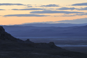
Mountain ranges in Nevada, commonly about 10 miles wide and rarely longer than 80 miles, are separated by valleys. The geologic structure that controls this basin-and-range topography is dominated by faults. Nearly every mountain range is bounded on at least one side by a fault that has been active, with large earthquakes, during the last 1.6 million years. For the last several million years, these faults have raised and occasionally tilted the mountains and lowered the basins. Over the years, these basins have filled with sediments that are derived from erosion of the mountains and that are locally tens of thousands of feet thick.
Many of the range-bounding faults are still active. Nevada is the third most seismically active state in the nation (behind California and Alaska); over the last 150 years, a magnitude 7 or greater earthquake has occurred somewhere in Nevada about once every 30 years. Most faults are normal, although some are strikeslip faults. The most apparent zone of strike-slip faults in Nevada is in a 50-mile wide swath along the northwesttrending border with California, the Walker Lane. These northwest-trending faults are accommodating part of the motion between the Pacific Plate, which is moving relatively northwest, and the North American Plate, which is moving relatively southeast. The San Andreas Fault takes up most of the motion between these two plates. The generally north-south trend of mountain ranges in most of Nevada transforms into northwest-trending ranges within the Walker Lane.
The climate of Nevada is closely tied to the geologic
structure and resultant topography. Judging from fossil
evidence of plants that grew in different parts of California
and Nevada in the past, the Sierra Nevada (in California
and far western Nevada) rose to current elevations only
within the last six million years. Today the Sierra Nevada
and other high mountains in California trap moisture
coming off the Pacific Ocean and leave Nevada the driest
state in the nation. Only a few rivers leave Nevada. These
include the Bruneau, Jarbidge, and Owyhee Rivers in
northeastern Nevada, which flow north into the Snake
River in Idaho, and the White and Virgin Rivers in
southeastern Nevada, which flow into the Colorado River The Colorado, which is the largest river in
Nevada, gets the bulk of its water from the Rocky
Mountains to the east and provides much of the municipal
and industrial water for Las Vegas and other communities
in southern Nevada before flowing southward into the
Gulf of California. Most of Nevada, however, is part of
the Great Basin, a large area with no drainage to the ocean
and centered on Nevada but including parts of California,
Oregon, Idaho, and Utah. The Truckee, Carson, and
Walker Rivers, which provide much of the drinking,
industrial, and agricultural water for northwestern
Nevada, flow generally eastward from the Sierra Nevada
to terminal lakes and lowlands in the desert (Pyramid
Lake, the Carson Sink, and Walker Lake, respectively).
The Humboldt River, which supplies much of
northeastern Nevada with drinking, agricultural, and
industrial water, flows southwestward into Humboldt
Lake, and, when the lake fills, into the Carson Sink.
During glacial times (most recently about 10,000
years ago), large expanses in the Great Basin were covered
by water. Great Salt Lake and the Bonneville Salt Flats
in Utah and parts of far eastern Nevada were once part of
ancient Lake Bonneville, and Pyramid Lake, the Carson
Sink, and Walker Lake were once connected in ancient
Lake Lahontan. Native Americans occupied the shores
of these lakes as early as 10,000 to 12,000 years ago.
Glaciers existed in the higher mountains, carving some
of the spectacular U-shaped valleys in the Ruby
Mountains (Fig. 4) and sculpting high-mountain
topography in the Sierra Nevada. Glaciers are still present
high in the Ruby Mountains and Snake Range in eastern
Nevada.
Groundwater, mostly from aquifers in alluvial basins,
is used throughout the state. In some basins, groundwater
has been pumped out more rapidly than it is naturally
recharged from rain and snowmelt; this causes significant
lowering of the groundwater table and can affect the land
surface. In Las Vegas Valley, cracks have developed
locally in the ground (near preexisting faults), and in a few places the land has subsided more than 6 feet in the last 60
years.
On a percentage basis, Nevada is the fastest growing state in the country. The U.S. Census Bureau reported a population of 1,201,833 in 1990 and 1,998,257 in 2000. Most of the increase has occurred in and around the urban areas of Las Vegas and Reno-Carson City. Urban expansion in the Las Vegas area has been at a rate of about two acres per hour and is expected to continue at a rapid rate. The Nevada State Demographer has projected the population to be 2.8 million in 2010. This increasing population places demands on groundwater and other resources.
The ecological regions of Nevada are directly linked to the
climate, elevations of the mountains, and rocks. A combination of
precipitation and rock type (with the help of ubiquitous microbes)
dictates the types of soils that develop and the plants that grow,
which, in turn, affect the types of animals that survive. Geologic
evidence (primarily fossils) shows us that climate has changed
substantially even within the last 10,000 years. For example,
mammoths and camels once lived near springs and now mostly
dry lakes in Nevada, as recently as 11,000 years ago.
Although Nevada is, on the average, quite dry (with about 10 inches of rainfall across the state, but locally less than 5 inches in some lowlands and over 40 inches in high mountains), major storms have caused significant floods and occasional landslides. Geologic evidence (and recorded history) abounds for large floods on the major rivers and “dry” washes throughout the state.
Major events in the geologic history of Nevada are highlighted in Table 1. A western continental margin, similar to the Atlantic coast of today, persisted for hundreds of millions of years before the more active, Pacific coast margin of today began to take shape about 360 million years ago. Repeated and prolonged periods of interactions between the North American Plate and oceanic plates, expressed in folds, thrust faults, strikeslip faults, normal faults, igneous intrusions, volcanism, metamorphism, and sedimentary basins, are recorded in the rocks.
Nevada rocks document volcanic and intrusive igneous activity intermittently and repeatedly from earliest geologic history to within the last few thousand years. Nevada’s igneous rocks are connected to sea-floor spreading about 450 million years ago (much like the Mid-Atlantic Ridge or the East Pacific Rise today), collisions of ancient and modern plates, and hot spots in the Earth’s mantle and perhaps outer core (some Nevada volcanic rocks can be correlated with the Yellowstone hot spot, which, as a result of plate tectonics, was once underneath and produced volcanoes in southern Idaho and northern Nevada). Some of the volcanic rocks in western Nevada represent the precursor of the Cascade Range, and significant intrusions about 40, 100, and 160 million years ago are probably linked to similar platetectonic settings, whereby oceanic plates were subducted beneath western North America.
Most, but not all, ore deposits in Nevada are associated with igneous activity. In some cases, metals came from the magmas themselves, and in other cases, the magmas provided heat for circulation of hot water that deposited metals in veins and fractured sedimentary rocks. Some spectacular mineral specimens occur in ore deposits that formed when magmas intruded and metamorphosed sedimentary rocks. Even today, driven locally by deep circulation along faults and perhaps locally by igneous activity, hot water shows up in numerous geothermal areas. Nevada produces approximately $100 million worth of geothermally generated electric power annually, and geothermal resources also are used for agriculture, industrial applications, and space heating.
Nevada produces approximately $3 billion worth of mineral commodities each year. Nevada is the nation’s leading gold producer, accounting for approximately 75% of U.S. production and 10% of world production. Much of the gold comes from a northwesttrending belt of gold deposits in northeast Nevada known as the Carlin trend. One of the interesting features of the Carlin trend is that nearly all of the gold is contained in microscopic particles within Paleozoic sedimentary rocks. Although the sedimentary hosts for the gold are more than 250 million years old, the actual mineralization may have occurred much later (approximately 40 million years ago) in association with igneous activity.
We are currently in the midst of the biggest goldmining boom in American history. The U.S. production so far in the current boom, the period from 1980 through 2002, has exceeded 170 million ounces of gold. This is significantly greater than the total production during the era of the California gold rush (1849 to 1859, with 29 million ounces), the Comstock (Nevada) era from 1860 to 1875 (with 34 million ounces), and the period from 1897 to 1920, when Goldfield (Nevada), the Black Hills (South Dakota), Cripple Creek (Colorado), and byproduct production from copper mines in Arizona and Utah contributed to cumulative production of 95 million ounces. Reserves on the Carlin trend and elsewhere in Nevada are sufficient to sustain the boom for at least two more decades.
Nevada, the Silver State, is also the nation’s leading
producer of silver, barite, mercury, and lithium. Much of
the silver is a co-product or by-product of gold production,
and all the mercury currently produced is a by-product
of precious metal recovery. Lithium is extracted from
brine that occurs in Tertiary valley-filling sediments near
Silver Peak. Other commodities that are
currently mined in Nevada include gypsum, limestone
(for cement and lime), clays, salt, magnesite, diatomite,
silica sand, dimension stone, and crushed rock, sand, and
gravel for construction aggregate. In the past, Nevada
has been a significant producer of copper, lead, zinc,
tungsten, molybdenum, and fluorite. Active exploration
and recent discoveries of new ore deposits attest to the
potential for finding additional ones.
Nevada became a State in 1864, during the Civil War (hence the motto “Battle Born”), in part as a result of mineral wealth. The 1859 discovery of silver-gold ores on the Comstock Lode enticed miners and prospectors, many of whom had come to California a decade earlier in search of gold. Over the decades that followed, they spread out from Virginia City, discovered other major mining camps, and established many nearby towns in Nevada (Austin, Battle Mountain, Beatty, Carlin, Elko, Ely, Eureka, Gabbs, Goldfield, Las Vegas, Lovelock, Pioche, Tonopah, Winnemucca, Yerington) and other parts of the western United States.
Nevada also produces some oil, although production
is small relative to that in major oil states. An interesting
aspect of Nevada petroleum production is that some of
the oil is associated with hot water, although lower in
temperature but otherwise much like the geothermal fluids
that formed gold and silver deposits. Another curiosity is
that some of the oil is trapped in fractured volcanic rocks,
although the ultimate source of the petroleum was from
organic matter in sedimentary rocks. Most of the oil has come from the eastern part of the state, primarily Railroad
and Pine Valleys.
Some environmental hazards are associated with the
abundant igneous rocks in Nevada. For example, many groundwaters in Nevada contain elevated concentrations
of radon. Because radon is common in silica-rich igneous
rocks, and because these rocks are widespread in the
mountains and make up much of the sediment in the
valleys, radon occurs in groundwater, soil, and air.
Similarly, arsenic is relatively abundant in certain types
of igneous rocks and is locally a problem as a dissolved
natural constituent in Nevada groundwater and surface
water. The proposed repository for high-level nuclear
waste at Yucca Mountain is in Tertiary ash-flow tuffs,
and Quaternary cinder cones occur nearby.
Given Nevada’s mineral, energy, and water resources,
its challenges in terms of environmental protection, and
its exposure to natural hazards, geology will continue to
play a central role in the state’s economy, growth, health,
safety, and history.
ACKNOWLEDGMENT
I thank Chris Henry, Steve Castor, Larry Garside, Jim Faulds, and Dick Meeuwig for help with earlier versions of this manuscript and Rick Schweickert and Jim Carr for constructive comments on this latest version.
BIBLIOGRAPHY
(references and suggested reading)
 Home
Home